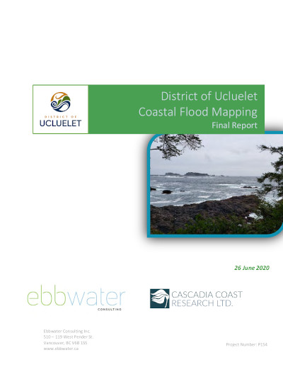
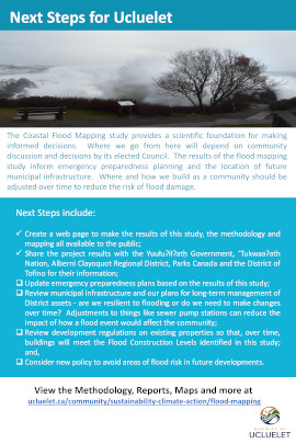
Flood Mapping Project

Overview of the Project
In February 2019, Council received a report from District staff requesting support for a funding application to the Community Emergency Preparedness Fund through the Union of BC Municipalities (UBCM) for a flood mapping project for Ucluelet.
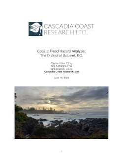
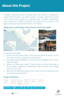
The purpose of the District of Ucluelet Flood Mapping Project was to engage a qualified professional engineering consultant experienced in coastal engineering to develop a flood risk assessment, flood plain mapping, establish a flood construction level (FCL), identify sea level rise planning areas, and identify flood hazards for the development of future land use policy.
The project was designed to help the District of Ucluelet meet its responsibilities as laid out in the updated Provincial Flood Hazard Area Land Use Management Guidelines, and to provide updated flood risk data accounting for climate change and future sea level rises.
Council gave their full support to the project and directed staff to proceed with the funding application and project.
Tsunami Risk Tolerance - Interim Policy
Timeline
A Request for Proposals (RFP) process was initiated in September 2019. The contract was awarded to Ebbwater Consulting Inc. in November 2019. The project and final reports were completed in June 2020.
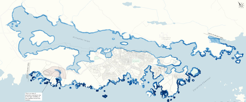
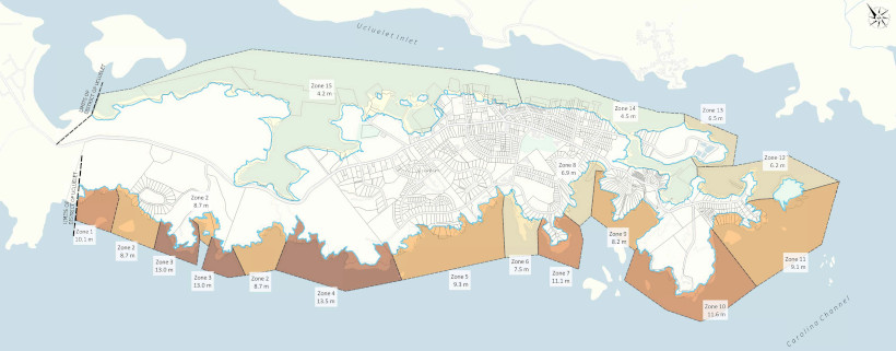
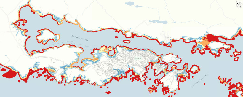
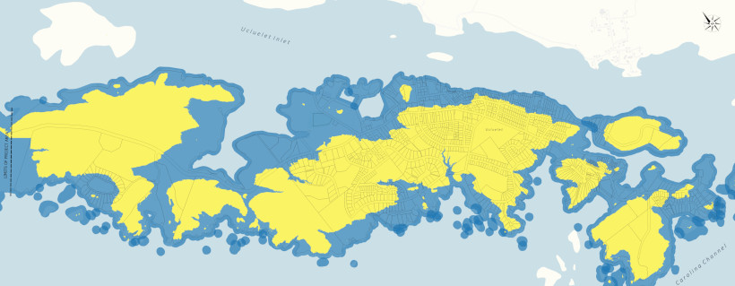
Flood Risk Data Gathering and Analysis
The project consisted of key activities and modelling designed to inform the flood mapping and flood risk reports:
- Definition of the Designated Storm(s) and the associated winds and storm surge
- A flood risk assessment and the Designated Flood Level, considering sea level rise, tide conditions and storm surge
- Characterisation of the incident wave climate approaching the shoreline
- Determination of wave effects and overtopping rates at the shoreline
- Calculation of the Flood Construction Levels (FCL)
- Determination of the location and quality of structures, people and assets that might be affected by flood within the District of Ucluelet area
Once all data and modelling had been completed, the new data will be used to:
- Inform community members and stakeholders of project findings and recommendations
- Update District of Ucluelet policies and bylaws such as the Official Community Plan (OCP) and Zoning Bylaw
- Improve community preparedness for flood emergencies
The data could also be used to inform the establishment of no-build areas, flood construction levels that account for predicted sea level rises and future designation of development areas that are outside of hazardous flood risk zones.
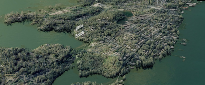
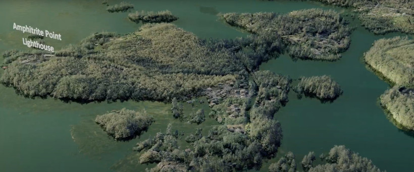
Project Reports, Video and Maps
Reports and maps can be found on our Technical Report, Appendices and Maps page.
The Tsunami Visualisation Video can be view on the Tsunami Flood Modelling Video page along with brief explanations of the different tsunami flooding scenarios.
View the Public Exhibit Posters
Links to Additional Background Resources
- BC Floodplain Mapping
- Adapting to Climate Change Video Series Brochure (PDF)
- BC Adapts – Coastal Flood Mapping
- Legislated Flood Assessments in a Changing Climate in BC (PDF)
More Information
If you have any comments or questions regarding the Flood Mapping Project, please contact Bruce Greig or John Towgood in the Community Planning Department.
Please note: We gratefully acknowledge the funding of this project by the Union of BC Municipalities (UBCM) from the Community Emergency Preparedness Fund.
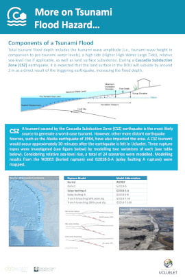
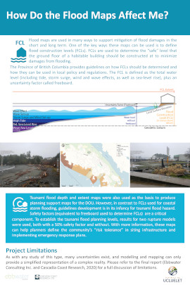
![]()