Ucluelet Maps & Directions

Driving to Ucluelet

If traveling by car, BC Ferries offers services from the Lower mainland (Vancouver) to Vancouver Island at two points - the Horseshoe Bay Terminal in North Vancouver and the Tsawwassen Terminal south of Vancouver.

Ferry services from Horseshoe Bay arrive at Departure Bay, Nanaimo

Ferry services from Tsawwassen arrive in Swartz Bay near Victoria, or at Duke Point, just south of Nanaimo.

For more information or to make a reservation, visit BC Ferries: www.bcferries.com, 1-888-769-3766.

Driving Distances and Travel Times to Ucluelet

  • From Tofino – 26 km (16 mi) 30 minutes
  • From Port Alberni – 100 km (62 mi) 1 hours 10 minutes
  • From Comox – 208 km (112 mi) 2 hours 45 minutes
  • From Nanaimo – 180 km (112 mi) 2 hours 30 minutes
  • From Victoria – 288 km (179 mi) 4 hours
  • From Vancouver – 196 km (122 mi), a ferry ride plus 2 hours 45 minutes driving
  • From Seattle – 422 km (262 mi), 2 hours ferry and 6 hours driving
  • When traveling north from Nanaimo, exit west on Provincial Highway 4 towards Port Alberni, Tofino and Ucluelet. Eventually, you will arrive at the junction of Highway 4 and the Pacific Rim Highway, which runs south 8 kilometres to Ucluelet or north through the Pacific Rim National Park Reserve to Tofino. Turn left at the junction.

Tip - Visit Drive BC for highway conditions & cameras at the Port Alberni Summit and Sutton Pass.

Marine Transportation

In the summer season passenger and cargo vessels can travel from Port Alberni to Ucluelet on the vessel Francis Barkley. It runs 3 days a week, summer only. For schedule and fare information visit www.ladyrosemarine.com

If you are coming by private boat, there is moorage available at Ucluelet's small craft harbour. It has 20 amp service, water and other marine services. It also has a recognized Canada Customs Clearance Centre. Call for more information: 250-726-4241.

Air Travel to Ucluelet

Tofino/Ucluelet Airport (YAZ)   is located near Pacific Rim National Park Reserve and is administered by the Alberni-Clayoquot Regional District. The airport has three 5,000 ft runways and scheduled and charter flights operate from here.

For international air travelers, the nearest international airports are Vancouver (YVR) on the mainland or Victoria (YYJ) on southern Vancouver Island. Other major airports on Vancouver Island are Nanaimo Airport (YCD) and Comox Valley Airport (YQQ).

Click on the links below to view driving directions to Ucluelet from Vancouver Island's airports:

Weather

ucluelet-Mild-Weather-Rainforest-and-OceanUcluelet Weather

Ucluelet is in the Pacific temperate rainforests eco-region which is the largest temperate rainforest eco-region on the planet as defined by the World Wide Fund for Nature. The Pacific temperate rainforests are characterized by a high amount of rainfall, more than 300 cm (120 inches) per year with 75% falling between October and March. The rainforest is also characterized by moderate temperatures in both the summer and winter months (between 10-24°C). These moderate temperatures make Ucluelet an ideal travel destination year round with activities such as hiking, surfing and beachcombing.

The spring and summer months provide a calmer marine weather for ocean-based activities like sport fishing, kayaking, whale and wildlife viewing.

Fall and winter in Ucluelet is an extraordinary place for storm watching. To the west, the arctic and subtropical air masses collide over the Pacific Ocean and create wild tempests that slam the coast with dramatic results. One of the west coast's best winter secrets is that these tempests are followed by a day or two of warm sunny conditions that are generally the warmest winter days in Canada.

environment-canada-ucluelet-weather weather-network2

First Nations Heritage and Culture

ucluelet-first-nationsNuu-chah-nulth-aht

The Nuu-chah-hulth-aht, comprised of 14 nations, have inhabited this coast for over 10,000 years. Their traditional society lived in harmony with the rich resources of the coastal temperate rainforest.  The governing body is the Nuu-chah-nulth Tribal Council.

Toquaht First Nation

"people of the narrow place in front," or "people of the narrow channel"

Toquaht First Nation has 7 Traditional Village Sites covering 196 hectares and is the smallest of the Nuu-chah-nulth Central Region Nations with 135 members, most of whom live away from home.

More Information

Ucluelet First Nation

Located on the West Coast of Vancouver Island, the Yuułuʔiłʔatḥ Government – Ucluelet First Nation (YG) traditional territory spans much of the area on the north end of Barkley Sound, including what is now the District of Ucluelet. The community of Hitacu holds a population of approximately 200 residents and is located across the harbour from Ucluelet.

More Information

History

ucluelet-historyThe Rich History of Ucluelet, Vancouver Island

Ucluelet (pronounced you-KLEW-let) is a local First Nations word meaning "people with a safe place to land". British Columbia's recorded history began with European explorers searching for the legendary Northwest Passage to the Orient. We know that the Europeans were not the first to perceive this land's wealth. Archaeological evidence indicates the presence of First Nations along this outer coast for at least 4300 years.

It was on the west coast of Vancouver Island, just 100 km north of Ucluelet, that Captain James Cook of the British Navy first set foot, in 1778. Captain James Barkley followed in 1787, arriving near Ucluelet harbour in Barkley Sound in search of sea otter pelts.

In 1870, fur sealers settled in the area. Captain Francis, the owner of several sealing schooners, established a trading post in Ucluelet harbour. Ucluelet began to grow along with the sealing industry and became a bustling little town.

European Settlers meet First Nations in the 1890's as more settlers began arriving on the news of pending road access from Port Alberni. Fishing was excellent and gold was to be found on Florencia Bay. The stories of gold were correct, but it was so fine and in such little quantity that it could not be worked profitably.

The Presbyterian Church built a Mission House and school and a doctor was dispatched to the area in 1898. By 1900, more settlers had moved to the west coast of Vancouver Island. Development began bringing infrastructure and services of all kinds. The Canadian Pacific Railway operated a small freight boat sailing from Victoria three times a month. In 1903 a whaling station was established in Barkley Sound. In Ucluelet a lighthouse, a government telegraph office, and a lifeboat station were built. As the First World War began, the fishing industry had started.

When World War II began the Government of Canada took measures to protect Vancouver Island's west coast from potential invasions. The military established a seaplane base in Ucluelet and a land base at Long Beach. The road to Tofino, which had been worked on for thirty years was finally completed.

Ucluelet continued to prosper after the war luring more residents hoping for prosperity to the beautiful region. In August 1959, the long awaited road to Port Alberni was finally opened.

Ucluelet became incorporated on February 26th, 1952. Its status was changed to a District in 1997 to reflect, in part, the increasing population and increasing importance within the region.

The Ucluelet Experience

ucluelet-experience3
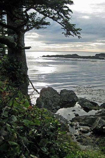
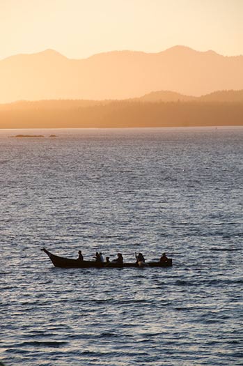
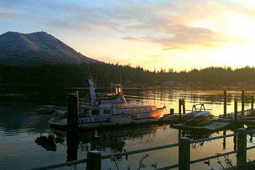
The environment of tranquil Ucluelet provides a stimulating and dramatic backdrop for working, living, and recreating. The town of Ucluelet offers beaches, multi-use sports fields, community parks, waterfront promenades, restaurants, unique shops and galleries, a mini aquarium and a range of accommodation choices. The motto of Ucluelet is "Living on the Edge" due in part to its location on a peninsula surrounded by water. This marine influence permeates Ucluelet from the climate, to events such as the Pacific Rim Whale Festival, to the design of buildings, which are uniquely West Coast.

Ucluelet is located 288 kilometres (km) northwest of the British Columbia provincial capital, Victoria, on the magnificent outer West Coast of Vancouver Island.

The closest city is Port Alberni, approximately 110 km to the east. The District of Tofino is 40 km northwest of Ucluelet.

In between Tofino and Ucluelet is the Long Beach Unit of the Pacific Rim National Park Reserve. Ucluelet provides easy water access to Barkley Sound; a spectacular marine area that features the Broken Group Islands Unit of the Pacific Rim National Park Reserve.

Ucluelet is growing as a major tourist destination and features stunning scenery, interesting events and activities, and a rich cultural history. The word Ucluelet (pronounced you-KLEW-let) is a local First Nations word meaning "safe harbour". Archaeological evidence indicates the presence of First Nations for at least 4300 years, and the area was settled in 1870 by fur sealers. Along with learning about Ucluelet's history, a key highlight for tourists is the easily accessible Wild Pacific Trail, which offers spectacular vistas of the Pacific Ocean and wildlife viewing opportunities. Recreational activities include surfing, fishing, whale watching, kayaking, camping, hiking, storm watching, biking, swimming, and beachcombing.